Measure the site. Then shape the home.
An Islamabad homeowner guide to plot records, survey scope, levels and the information your design team needs.
Same foundations.
A brighter tomorrow.

01 / Start with the plot, before the floor plan
Before commissioning a house design in Islamabad, confirm the plot records and responsible authority, agree a measured site survey with your design team, and resolve differences between the documents and the ground. Ask for a dated drawing that records the agreed features, levels and limitations. A plot-size label or a location pin alone is not a complete design brief.
This guide helps a homeowner organise that early decision. It does not establish ownership, approve a building or prescribe a foundation. Those questions need the relevant authority and appropriately qualified professionals. The aim is a clear starting record that the architect, engineer and owner can all use.
For example, a family might have a preferred room layout but no agreed information about the road-side level or the location of existing services. Rather than treating those gaps as details to solve during excavation, list them before approving the design. This is a hypothetical planning example, not a completed ELEV8CONCEPTS project.
02 / Identify the Islamabad authority and plot record
Begin with the exact plot reference, sector or scheme name and the available allotment, transfer, possession and site documents. Ask your appointed architect which authority and scheme requirements apply to that particular address. A marketing description using Islamabad does not by itself establish the approval route.
CDA's Planning and Design page distinguishes Building Control City, North and South responsibilities. It also lists handing over possession of CDA plots and topographic surveys of CDA land among its Land Survey Division functions. These are useful official starting points for identifying the appropriate office; they do not mean that a private survey replaces official possession or demarcation.
CDA Planning and Design: directorates and Land Survey Division
CDA's building-plan FAQ lists allotment or transfer records and a possession certificate among the supporting documents for its process. Confirm the current checklist with the responsible office and your architect. This guide does not repeat fees, promise a processing time or apply one authority's checklist to every scheme.
03 / Agree what the survey needs to answer
A useful instruction starts with its purpose: information for an architect preparing a new home design. Ask the architect and surveyor to agree the area to cover, detail needed, suitable accuracy, access arrangements and output formats before comparing quotations.
RICS' measured-survey standard explains that a survey specification should clarify detail, accuracy, reference systems, deliverables and omissions. Its general scoping principles help frame questions for a professional; they are not a substitute for Islamabad's applicable requirements.
RICS: measured surveys of land, buildings and utilities
Use a short written brief and ask the team which of these subjects need to appear:
- The relationship between the measured plot and supplied plot documents.
- Existing walls, structures, trees and other features relevant to the design.
- Ground and adjacent road levels, with a clear reference explained by the surveyor.
- Access points and visible service features within the agreed survey area.
- Areas that cannot be accessed or information that requires another investigation.
Do not request a generic certificate and assume it answers every question. Agree the deliverable with the people who will use it, and ask what is excluded from the quoted service.
04 / Keep measurements and boundary decisions separate
A measured drawing records observations within its stated scope. Do not assume that a nearby wall or a stake proves the legal boundary, or that a surveyor's drawing automatically settles a disagreement with a neighbour.
RICS describes a topographic survey as a record of natural and built features and notes that a survey prepared for one purpose may be unsuitable for another. Its consumer article is written for the UK; its land-registration rules should not be transferred to Pakistan.
RICS consumer guide: topographic surveys and their purpose
If the dimensions or physical markers do not agree with the documents, record the discrepancy and ask the relevant authority and professional advisers how to resolve it. Keep the response with the survey. Do not move markers, alter a boundary or authorise excavation based on an unresolved assumption.
An owner-friendly question is: which lines on this drawing were measured, which came from supplied records, and which still need confirmation? Ask for the distinction to remain visible in the issued information.
05 / Review levels and access with the design team
Ask the architect to explain how the measured site affects the entrance, vehicle approach, ground-floor arrangement and relationship to neighbouring land. Where the engineer needs further information, add that request to the same open-question list.
The survey records conditions; the professionals develop and check the design. Do not select a plinth height, excavation depth or retaining solution from a generic online example. Have the responsible team explain the proposed approach for your actual plot and applicable requirements.
Keep decisions in plain language. A useful meeting note might say that the entrance arrangement remains provisional until the road-level information is reviewed. It should identify who will obtain the information and who will confirm the design response. Avoid labelling a drawing final while a major site assumption remains unresolved.
06 / Ask what is still unknown below ground
A visible site inspection is not proof of every buried pipe or cable, nor is a topographic drawing a geotechnical report. Ask your professionals whether separate utility information, detection or ground investigation is needed for the project. Let them define the method and limitations rather than prescribing a standard number of boreholes or a foundation type here.
Treat inaccessible locations and uncertain information as explicit follow-up items. Ask who will coordinate with the relevant service provider or authority and when the answer is needed. A blank area on a drawing should not silently become an assumption that nothing is present.
This is also a useful budget discussion. Separate the known survey scope from possible additional investigations, access visits and design revisions. Obtain written scope and prices from the appointed providers; there is no universal Islamabad survey price used in this article.
07 / Make the survey handover usable
Before closing the instruction, arrange a review with the architect and surveyor. As an owner, you can check whether the agreed files were received and questions answered; the technical suitability of the information belongs with the qualified team.
- Match the drawing's plot reference to your instruction.
- Keep the survey date, drawing number and revision together.
- Ask for a readable PDF and any agreed design-file format.
- Retain the scope, exclusions and unresolved questions alongside the drawing.
- Record who received the files and which revision the design team will use.
Keep a simple action list with question, responsible person, next step and status. If later site work changes a relevant condition, ask whether the information needs updating before another team relies on it. Preserve superseded versions separately so an old attachment is not mistaken for the current drawing.
For an overseas owner, nominate a local contact for access and receive the same dated pack as the architect. Photos or a video call help explain the site, but do not replace professional measurements or the official plot process. Keep identity and ownership documents in private project records, not public progress links.
08 / Turn the site record into the design brief
Once the responsible team has reviewed the site information, combine it with the family's room needs, accessibility priorities, budget and intended construction stages. Ask which decisions are confirmed and which remain conditional before approving the next drawing issue.
Develop the room-by-room house floor-plan brief
When discussing an Islamabad project with ELEV8CONCEPTS, share the location, current stage and the documents already available. Ask us to confirm the services available for your specific brief and location before arranging work. This article does not imply an Islamabad office or guaranteed service coverage.
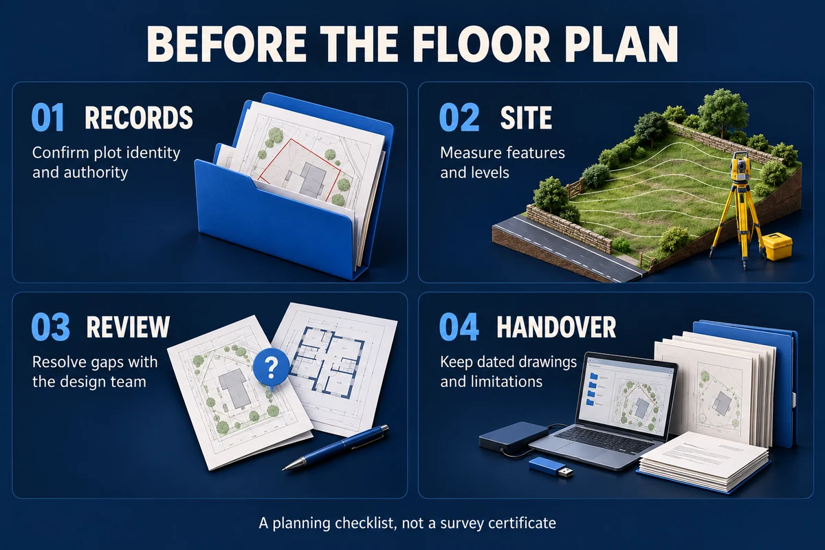
Before the floor plan.
Clear records help you follow decisions, review progress and keep the details that matter.
- Records — confirm plot identity and responsible authority.
- Site — agree the measured features, levels and limitations.
- Review — resolve gaps with the architect and relevant professionals.
- Handover — retain dated drawings, scope and open questions.
Common questions.
Do I need a plot survey before designing a house in Islamabad?
Ask your architect what measured site information is needed for the design and what the responsible authority requires. Agree the survey scope before commissioning it; a plot-size label or location pin alone does not answer all design questions.
Is a topographic survey the same as a soil investigation?
No. A topographic survey records features and levels within its agreed scope. Ask the engineer whether a separate ground investigation is required and what it should cover. Do not choose a foundation from a generic checklist.
Does a measured plot drawing prove the legal boundary?
Do not treat it as automatic proof. Ask which features were measured and which lines came from supplied records. Refer discrepancies to the responsible authority and appropriate advisers before altering boundaries or starting excavation.
What should an overseas owner receive from the survey team?
Request the agreed dated drawings, plot reference, revision, scope, limitations and unresolved questions. Have the architect confirm the information is suitable for its intended use, and keep ownership and identity documents in private records.